Planning
Overview: Yosemite National Park consists of lakes, rivers, waterfalls, mountains, meadows, and forests. Late spring is my preferred time to visit the park, when the waterfalls are at peak flow. The park is large - it can take at least one hour to drive from one end to the other. Make sure to account for driving from the entrance to your destination, in addition to the drive time from your origin to an entrance. The park can become crowded during the day - especially at peak times (weekends, holidays, summer) so try to arrive before 9am.
Airport: I flew into Fresno, closest airport to Yosemite National Park. Fresno is 1.5 hour drive to the closest entrance, which is the south entrance. Nice small airport. The rental car counters are across from baggage claim.
Lodging: I stayed at Yosemite Valley Lodge, located in the middle of Yosemite Valley. Perfect location for exploring the valley. There is another lodge named Yosemite View Lodge, which is located in El Portal and is 30 minute drive to the valley. The names are almost identical, so make sure you know which lodge you are booking if choosing one of them.
 |
| Sunset reflecting on the mountains, as my flight was landing in Fresno. |
Mariposa Grove
Home to many giant sequoias, whose trunks can be over 25 feet/7.6 meters wide. Some of the trees have burnt marks - this is because fires help these trees reproduce. Fires help burn away dead branches and debris and expose soil for seeds to take root.
I started off walking on the Washburn Trail, then turned onto Mariposa Grove Trail and hiking to the California Tunnel Tree. Then hiked on Grizzly Giant Loop Trail and then the Mariposa Grove Road back to the parking lot. 6.5 miles/10.4 km hiking. Drove to Yosemite Valley, where I would spend the rest of this trip.
 |
| Fallen Monarch |
 |
| Bachelor and Three Graces |
 |
| El Capitan, from the north side of the loop |
 |
| El Capitan from the south side of the loop |
 |
| Cathedral Spires |
Tunnel View
 |
| One end of a mile long tunnel |

 |
| Overlook at Tunnel view. Can see El Capitan, Half Dome, and Bridalveil Falls. |
 |
| Near sunset, the top of Half Dome shines like a lighthouse beacon. |
 |
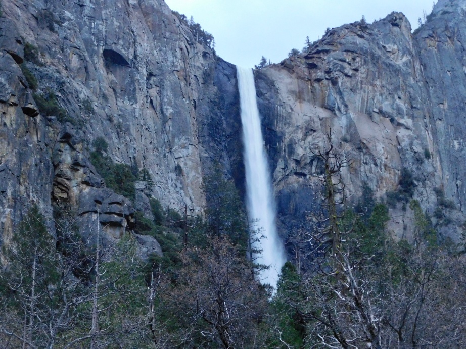
| Bridalveil Falls from Tunnel View |
 |
| Close up of Bridal veil Falls at Tunnel View |
 |
| Silver Strand Falls, which only flows after high snowmelt. |
 |
| Horsetail Falls - the small white line in the top-middle. This waterfall only appears during late winter and spring. |
Yosemite Falls Hike
The
Yosemite Falls trail is 1 mile/1.6 km loop. It goes through a forest and leads to the base of the Lower Falls. Lots of views of the upper and lower falls along the trail.
Mirror Lake Hike
4 mile/6.4 km hike, starting on Happy Isles Road then turning onto Mirror Lake Trail. Snowmelt in the mountains runs off into the valley forming Tenaya Creek. The water from snowmelt collects in the meadow forming Mirror Lake. This lake only appears in spring when snow is melting. In summer Mirror Lake dries and becomes Mirror Meadow.
 |
| Rapids at Tenaya Creek |
 |
| Beautiful reflections at Mirror Lake |
 |
| Mirror Lake with Half Dome in the background |
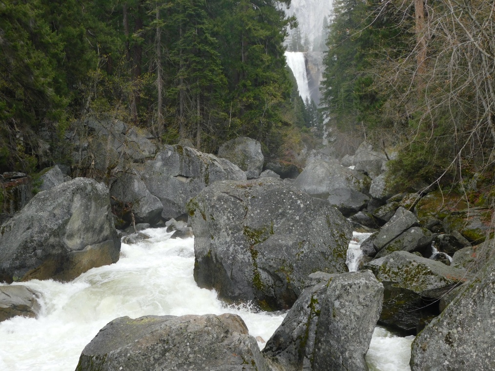
Mist Trail Hike
Strenuous hike to see
Vernal and
Nevada Falls up close. 8 miles/12.87km roundtrip and 2,000 feet/609 meters elevation gain. Started on Mist Trail with a brief visit to Happy Isles, then continued along the trail to Vernal Falls Bridge where I can see both Vernal and Staircase Falls. Then climbed 600+ steps up a cliff to get to the base of Vernal Falls. Continued climbing to get to the top of Vernal Falls, and then more climbing to reach Nevada Falls. After admiring Nevada Falls from several viewpoints, headed back down on the John Muir Trail.
 |
Happy Isles
|
 |
| Staircase Falls |
 |
| Vernal Falls bridge - first appearance of Vernal Falls. |
 |
| Long staircase along the cliff leads to Vernal falls viewpoint. |
 |
| Made it to Vernal Falls :) |
 |
| Looking down from base of Vernal Falls |
 |
| Top of Nevada Falls |
 |
| Small waterfalls near Nevada Falls. Hikers get to walk behind these waterfalls and get a good soaking. |